ACTIVE POWER PLANT

Dordi Khola Hydropower Plant

27MW

Developed by Himalayan Power Partner Ltd. (HPPL), this Run-of-River project harnesses the power of the Dordi Khola to contribute 148.249 GWh of annual energy to Nepal’s national grid.

PROJECT DETAILS

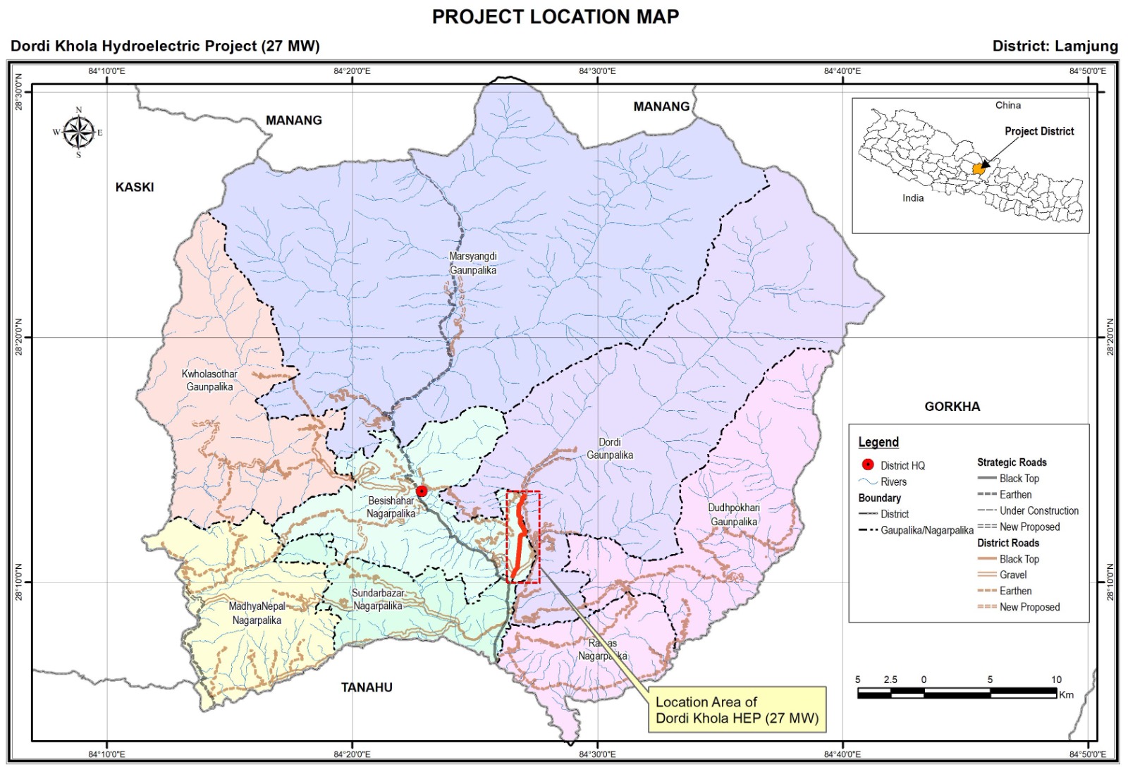
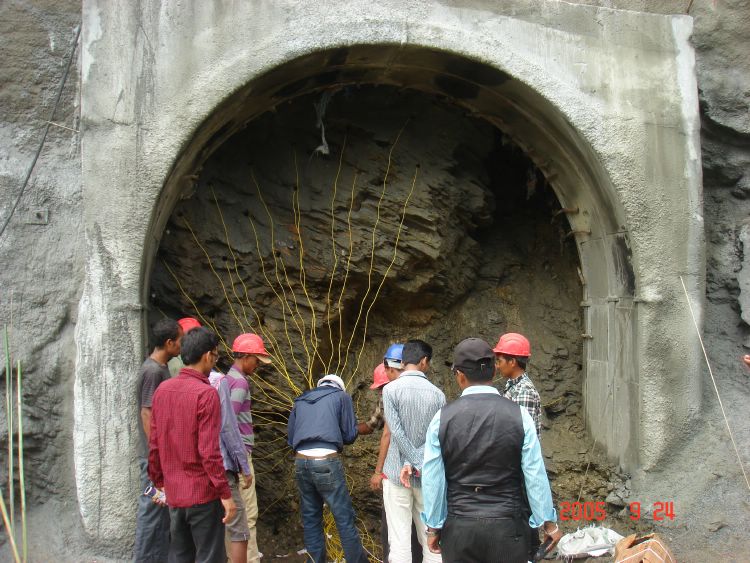
Dordi Khola Hydropower Project on the Dordi Khola is a run of the river type project in Dordi Rural Municipality and Besisahar Municipality – 11 of Lamjung District. The company started the construction of the project in 2015 and completed in 2022. The delay in the completion of the project was basically because of the impact of 2015 devastating earthquake, India-Nepal border blockade, devastating flood of 2021, COVID 19 and unpreparedness of Transmission Line to be constructed by Nepal Electricity Authority (NEA).

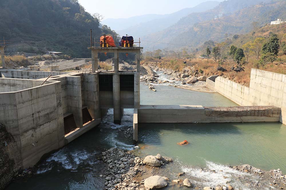
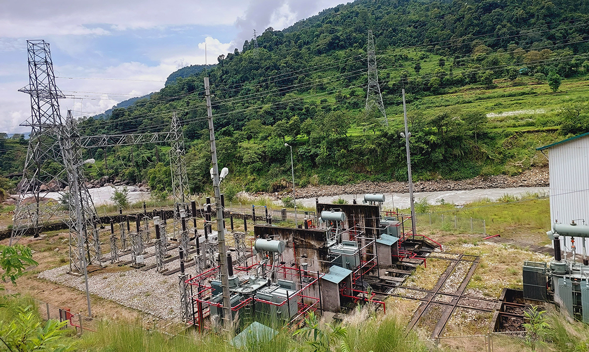
The headworks structures of the project lie at an elevation of 758m asl on Dordi Khola in Chiti, Nauther and Bansar village junction and the surface powerhouse is situated on the left bank of Marshyangdi River at an elevation of 551masl and about 500 m upstream from the confluence of Dordi Khola and Marshyangdi River in Chiti, of Besisahar Municipality. The gross head of the Project is 212 m and the design discharge 15.28 m3/s. The annual average contract energy is 142 GWh, out of which dry season energy is 21 GWh and the wet season energy is 121 GWh. The generated power is being evacuated to the national grid through the Middle Marshyangdi HEP substation as an alternative arrangement. The connecting point of Dordi Khola HEP (27 MW) as per the connection agreement is at Udipur substation hub which is still not completed.

The project was completed with the total cost of about NPR 5.28 billion Including IDC. The project was financed by a consortium of banks and financial institutions led by Prime Commercial Bank Ltd., Kamalpokhari, Kathmandu with the debt equity ratio of 75:25.

Technical Matrix.

RIVER SOURCE

Dordi Khola

TYPE OF SOURCE

Run of the river(ROR)

POWER CAPACITY

27,000 KW

GROSS HEAD

212.10 m

ANNUAL ENERGY

147.69 GWh

DESIGN DISCHARGE

15.28 m3/sec

TRANSMISSION

32 kV Single line

LENGTH

1.2 km

TIMELINE

Project Development Milestones.

Survey License
26th May 2005
Generation License
7th July 2011
Initial Environmental Examination (IEE)
4th October 2010
Power Purchase Agreement (PPA)
15th June 2012
Construction Start Date
March 2015
Detailed Design/ Construction Supervision
Entura Hydro Tasmania/ HPPL
Commercial Operation Date (COD)
30th September 2022
DETAILED ENGINEERING

Salient Features of the Project.

TYPE
Ogee type free over flow
CREST ELEVATION
762.0 m
LENGTH
85 m (Including undersluice)
MAX FLOOD LEVEL
764.78 amsl
CHAMBERS
2
DIMENSION
71 m x 10.20 m x 5.50 av.m
PARTICLE SIZE TO BE SETTLED
Up to 0.20 mm
LENGTH OF CONDUCTOR PIPE
3200 m (2.65 m dia.)
HEADRACE TUNNEL LENGTH
2780 m (D-shape 4.30m)
HEADRACE TUNNEL SIZE
4.30 m
PENSTOCK PIPE LENGTH
877 m (2.3m dia)
SURGE SHAPE
Circular
HEIGHT
20 m
DIAMETER
12 m
TYPE
SURFACE
Turbine Axis level
547.04 m
TYPE
RCC Box culvert
LENGTH
400 m ( 3.0 m x 2.1 m)
PROJECT LOCATION MAP

The project is located at Chiti of Besisahar Municipality of Lamjung District, Gandaki Province.

The project is located at Chiti of Besisahar Municipality of Lamjung District, Gandaki Province. The intake site is located at Chiti, Bansar, Nauther about 10 km from the powerhouse site at Ramchowk Besi, Chiti. The powerhouse area is located about 500 m upstream of the confluence of Dordi Khola and Marshyangdi River.

The Project area is located within the following geographical locations; however, the project boundary has been marked in the issued Generation License is up to the level 774.0 m amsl upstream of the diversion weir.
Longitudes from: 84º-26′-00″ E to 84º-28′-30″ E;
Latitudes from: 28º-10′-00″ N to 28º-13′-32″ N

The project area is accessible through metaled road about 170 km from Kathmandu to the Powerhouse site. Headworks area is located about 10 km upstream from the powerhouse area through Udipur – Kirtipur Road.

PHOTO GALLERY

Project Photos