
TIPLYANG KALIGANDAKI HEP
|
Tiplyang Kali Gandaki Hydroelectric Project is proposed on the Kali Gandaki River in Annapurna Rural Municipality of Myagdi District. As stated earlier the Project will be a combined cascade of Middle Kali Gandaki HEP and Mristi 2 HEP. Both of these upstream projects area run of the river schemes. TKGHEP will thus also be a run of the river scheme. It will have tapping arrangement downstream of Tatopani Bazar near the confluence of the Kali Gandaki River and the Ghar Khola and powerhouse at the confluence of the Kali Gandaki River and the Beg Khola.
The generated power will be evacuated by double circuit 132kV transmission line to Dana Substation constructed at Dana north of Tatopani Bazar of Myagdi District.The installed capacity of the Project now is 86 MW with a design discharge of 71.3 m 3 /s and net head 136.27m. The main waterway will be concrete lined modified horse-shoe shaped headrace tunnel with 5.8m finish diameter and of 6.9km length. Steel penstock pipe will of 4m diameter and 300m length. |
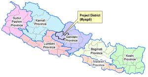 |
The project area of Tiplyang Kali Gandaki Hydroelectric project is located in Annapurna and Raghuganga Rural Municipality of Myagdi District, Gandaki Province, Nepal. All components of the project have been located in Annapurna and Raghuganga Rural Municipality whereas proposed headworks has been located at the Pokhare Bagar of ward no. 6 of Annapurna Rural municipality. Kholsi crossing and adit portal area have located at the place namely Doba and Beg Khola villages respectively. Surface powerhouse and underground Surge Shaft have located in Beg Khola village.
The powerhouse location at the confluence of the Beg Khola and the Kali Gandaki River, the project boundary needs to be extended. The Project is easily accessible. In fact, all the structures of the Project lie adjacent to the Beni-Jomsom-Korala Highway. The Project’s headworks site, which is the tailrace tapping location, is at distance of 97km from Pokhara and 20km north from Beni bazar. Pokhara is the regional center and Beni is the district headquarter of Myagdi. Currently, the highway between Beni and Jomsom is being upgraded to 4 lanes by the Department of Roads.
| Location Type of Project => Run-of-River (RoR) Rural Municipality => Annapurna Rural Municipality District => Myagdi Project => Tiplyang Kaligandaki River => Kali Gandaki Preject Area => Easting ~ Lat. 28°26’03” N to 28°28’55” N Northing~ Long. 83°36’03” E to 83°38’51” E |
Hydrology Catchment Area of => 3646 km² Intake Design Discharge => 71.3 m³/s Probability of exceedance of Design Flow => 40% |